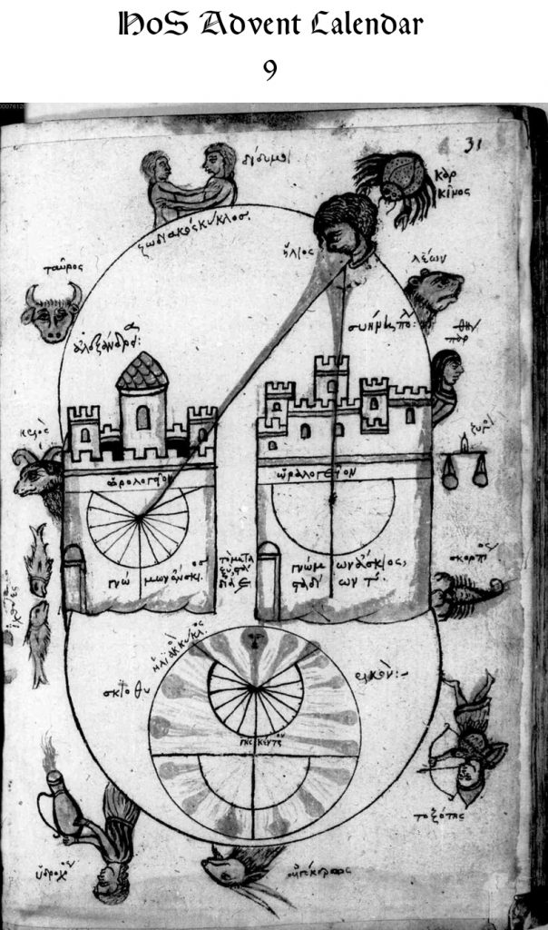
In this 13th/14th-century copy of Cleomedes’ textbook on astronomy, typically referred to as “De motu circulari corporum caelestium,” is this illustration of Eratosthenes’ method for calculating the circumference of the earth. The outer oval is the signs of the zodiac in their zoomorphic/anthropomorphic forms, each labeled with its name. The sun is located in Cancer, in the upper right, illustrated by a head looking down and the label “ἥλιος.” Rays of light stream down on two cities. On the right is Syene; on the left is Alexandria (labeled accordingly). The city walls of each are adorned with a sundial. The gnomon on the dial in Syene is casts no shadow, since the sun shines down directly on the city. The gnomon in Alexandria would clearly cast a shadow, since the sunlight shines on the town at an angle. Between the two towns is a distance of 5,000 stadia, as noted by the “τὸ μεταξὺ στάδια Ε.” In the bottom is an illustration showing the path of the sun.
Cleomedes was a Greek astronomer active sometime in late antiquity (scholars don’t agree on when he lived). He is known primarily for his work, On the Circular Motions of the Celestial Bodies, a kind of textbook on astronomy. He preserves previous authors’ work, especially much of Posidonius’s work. He is also the earliest source for the story illustrated here about how Eratosthenes measured the circumference of the earth.